 vesseltracker.com
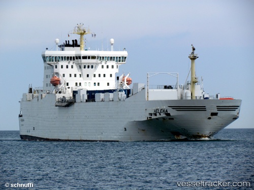
 PEACELAND
Current Status
Where is the vessel?
PEACELAND is currently in Near Umm Qasr Port, based on AIS data received less than 1h ago.
Latest AIS update:
Current position: 30.06144° N, 47.92610° E (Near Umm Qasr Port)
Average speed (last 7 days): Loading…
Average speed (last 30 days): Loading…
Vessel profile: PEACELAND is a Ro-Ro Cargo with dimensions m x m.
This page combines live AIS, route history, probable destination signals, nearby traffic, and port activity for practical vessel monitoring.
The current position of vessel PEACELAND is 30.06144 lat / 47.92610 lng. Updated: 2026-05-14 21:27:07 UTCNearest reference points:
- Near KHOR AL ZUBAIR
- Near Abadan
- Near Doha
Currently sailing under the flag of Saint Kitts and Nevis ![]()
Details:
Live Vessel PEACELAND Analytics (details, animations, etc.)
Recent AIS points (UTC):
2026-05-14 17:54:10 UTC · 30.06144, 47.92611 · SOG 0 kn · COG 143°2026-05-14 19:29:40 UTC · 30.06144, 47.92609 · SOG 0 kn · COG 142°
2026-05-14 20:14:37 UTC · 30.06141, 47.92608 · SOG 0 kn · COG 143°
2026-05-14 21:27:07 UTC · 30.06144, 47.92610 · SOG 0 kn · COG 143°