 vesseltracker.com
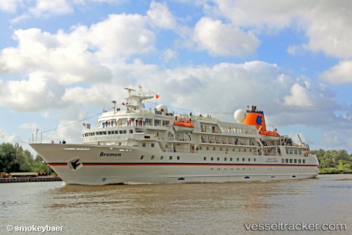
 SEAVENTURE
Current Status
Where is the vessel?
SEAVENTURE is currently in 13 nm NE of North Ronaldsay Apt, based on AIS data received about 1h ago.
Latest AIS update:
Current position: 59.54017° N, 2.17122° W (13 nm NE of North Ronaldsay Apt)
Average speed (last 7 days): Loading…
Average speed (last 30 days): Loading…
Vessel profile: SEAVENTURE is a Passengers Ship with dimensions m x m.
This page combines live AIS, route history, probable destination signals, nearby traffic, and port activity for practical vessel monitoring.
The current position of vessel SEAVENTURE is 59.54017 lat / -2.17122 lng. Updated: 2026-05-18 01:33:55 UTCNearest reference points:
- Near Tingwall
- 36 nm NW of Ham Voe, Foula
- 32 nm NW of Eshaness
Currently sailing under the flag of Bahamas ![]()
Details:
Live Vessel SEAVENTURE Analytics (details, animations, etc.)
Recent AIS points (UTC):
2026-05-17 22:19:01 UTC · 58.99242, -2.56376 · SOG 9 kn · COG 56°2026-05-17 23:31:00 UTC · 59.13698, -2.34916 · SOG 11.6 kn · COG 25°
2026-05-18 01:31:23 UTC · 59.53095, -2.17233 · SOG 13.2 kn · COG 3°
2026-05-18 01:33:55 UTC · 59.54017, -2.17122 · SOG 13.2 kn · COG 3°