 vesseltracker.com
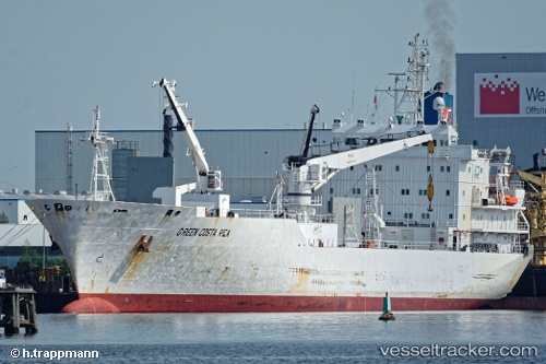
 Green Costa Rica
Current Status
Where is the vessel?
Green Costa Rica is currently in Near SOYO, based on AIS data received less than 1h ago.
Latest AIS update:
Current position: 6.12381° S, 12.24839° E (Near SOYO)
Average speed (last 7 days): Loading…
Average speed (last 30 days): Loading…
Vessel profile: Green Costa Rica is a Refrigerated Cargo Ship with dimensions 131m x 20m.
This page combines live AIS, route history, probable destination signals, nearby traffic, and port activity for practical vessel monitoring.
The current position of vessel Green Costa Rica is -6.12381 lat / 12.24839 lng. Updated: 2026-05-14 16:18:14 UTCNearest reference points:
- Near SOYO
- 11 nm W of Cabinda
- Near Futila Terminal
Currently sailing under the flag of Bahamas ![]()
Green Costa Rica built in 1992 year
Deadweight:
7726 tDetails:
Live Vessel Green Costa Rica Analytics (details, animations, etc.)
Recent AIS points (UTC):
2026-05-14 13:46:15 UTC · -6.12333, 12.24667 · SOG 0 kn · COG -1°2026-05-14 14:09:13 UTC · -6.12336, 12.24785 · SOG 0.3 kn · COG 194°
2026-05-14 16:09:13 UTC · -6.12384, 12.24831 · SOG 0.3 kn · COG 210°
2026-05-14 16:18:14 UTC · -6.12381, 12.24839 · SOG 0.3 kn · COG 217°