 vesseltracker.com
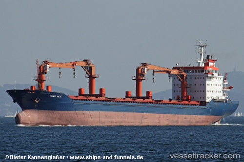
 Zinnet Mete
Current Status
Where is the vessel?
Zinnet Mete is currently in Near NEMRUT, based on AIS data received about 21h ago.
Latest AIS update:
Current position: 38.76517° N, 26.91477° E (Near NEMRUT)
Average speed (last 7 days): Loading…
Average speed (last 30 days): Loading…
Vessel profile: Zinnet Mete is a General Cargo Ship with dimensions 139m x 20m.
This page combines live AIS, route history, probable destination signals, nearby traffic, and port activity for practical vessel monitoring.
The current position of vessel Zinnet Mete is 38.76517 lat / 26.91477 lng. Updated: 2026-04-10 07:39:43 UTCNearest reference points:
- Near NEMRUT
- Near Nemrut Bay
- Near Aliaga
Currently sailing under the flag of Turkey ![]()
Zinnet Mete built in 1993 year
Deadweight:
12231 tDetails:
Live Vessel Zinnet Mete Analytics (details, animations, etc.)
Recent AIS points (UTC):
2026-04-10 02:15:42 UTC · 38.76517, 26.91477 · SOG 0 kn · COG 154°2026-04-10 04:00:43 UTC · 38.76519, 26.91477 · SOG 0 kn · COG 154°
2026-04-10 05:33:43 UTC · 38.76518, 26.91480 · SOG 0 kn · COG 154°
2026-04-10 07:39:43 UTC · 38.76517, 26.91477 · SOG 0 kn · COG 154°