 vesseltracker.com
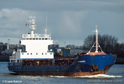
 ANASTASIA K II
Current Status
Where is the vessel?
ANASTASIA K II is currently in Near Araxos, based on AIS data received about 1h ago.
Latest AIS update:
Current position: 38.25485° N, 21.47225° E (Near Araxos)
Average speed (last 7 days): Loading…
Average speed (last 30 days): Loading…
Vessel profile: ANASTASIA K II is a General Cargo with dimensions m x m.
This page combines live AIS, route history, probable destination signals, nearby traffic, and port activity for practical vessel monitoring.
The current position of vessel ANASTASIA K II is 38.25485 lat / 21.47225 lng. Updated: 2026-05-14 12:17:22 UTCNearest reference points:
- Near Káto Achaïa
- Near MESSOLOGGI
- Near Meganísi
Currently sailing under the flag of Greece ![]()
Details:
Live Vessel ANASTASIA K II Analytics (details, animations, etc.)
Recent AIS points (UTC):
2026-05-14 07:26:12 UTC · 37.64968, 21.19973 · SOG 8.9 kn · COG 336°2026-05-14 09:35:52 UTC · 37.95317, 21.09720 · SOG 9.1 kn · COG 36°
2026-05-14 10:07:41 UTC · 38.02033, 21.15950 · SOG 9.4 kn · COG 37°
2026-05-14 12:17:22 UTC · 38.25485, 21.47225 · SOG 10 kn · COG 75°