 vesseltracker.com
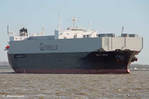
 Grouse Arrow
Current Status
Where is the vessel?
Grouse Arrow is currently in 47 nm E of Wenling Longmen Port, based on AIS data received about 3h ago.
Latest AIS update:
Current position: 28.48490° N, 122.86167° E (47 nm E of Wenling Longmen Port)
Average speed (last 7 days): Loading…
Average speed (last 30 days): Loading…
Vessel profile: Grouse Arrow is a Multi Purpose Carrier with dimensions 185m x 30m.
This page combines live AIS, route history, probable destination signals, nearby traffic, and port activity for practical vessel monitoring.
The current position of vessel Grouse Arrow is 28.48490 lat / 122.86167 lng. Updated: 2026-05-02 18:58:06 UTCNearest reference points:
- 42 nm E of Wenling Longmen Port
- 55 nm E of Wenling Longmen Port
- 60 nm NE of Wenling Longmen Port
Currently sailing under the flag of Bahamas ![]()
Grouse Arrow built in 1991 year
Deadweight:
42276 tDetails:
Live Vessel Grouse Arrow Analytics (details, animations, etc.)
Recent AIS points (UTC):
2026-05-02 18:58:06 UTC · 28.48490, 122.86167 · SOG 10.7 kn · COG 215°2026-05-02 18:58:06 UTC · 28.48490, 122.86167 · SOG 10.7 kn · COG 215°
2026-05-02 18:58:06 UTC · 28.48490, 122.86167 · SOG 10.7 kn · COG 215°
2026-05-02 18:58:06 UTC · 28.48490, 122.86167 · SOG 10.7 kn · COG 215°