 vesseltracker.com
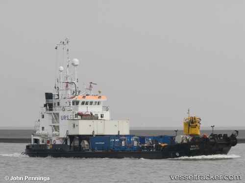
 Seisund
Current Status
Where is the vessel?
Seisund is currently in Near ROSENDAL, based on AIS data received less than 1h ago.
Latest AIS update:
Current position: 60.00483° N, 5.95750° E (Near ROSENDAL)
Average speed (last 7 days): Loading…
Average speed (last 30 days): Loading…
Vessel profile: Seisund is a Salvage Ship with dimensions 56m x 13m.
This page combines live AIS, route history, probable destination signals, nearby traffic, and port activity for practical vessel monitoring.
The current position of vessel Seisund is 60.00483 lat / 5.95750 lng. Updated: 2026-05-14 08:27:26 UTCNearest reference points:
- Near ROSENDAL
- Near OMASTRANDA
- Near Halsnøy
Currently sailing under the flag of Norway ![]()
Seisund built in 1991 year
Deadweight:
615 tDetails:
Live Vessel Seisund Analytics (details, animations, etc.)
Recent AIS points (UTC):
2026-05-14 04:34:46 UTC · 59.98550, 6.00583 · SOG 0 kn · COG 37°2026-05-14 05:45:45 UTC · 59.98550, 6.00583 · SOG 0 kn · COG 38°
2026-05-14 08:01:55 UTC · 60.00150, 5.95833 · SOG 0.1 kn · COG 328°
2026-05-14 08:27:26 UTC · 60.00483, 5.95750 · SOG 0.2 kn · COG 54°