 vesseltracker.com
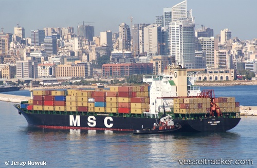
 Msc Mandy
Current Status
Where is the vessel?
Msc Mandy is currently in 62 nm W of Sanyang, based on AIS data received about 1h ago.
Latest AIS update:
Current position: 13.44283° N, 17.79391° W (62 nm W of Sanyang)
Average speed (last 7 days): Loading…
Average speed (last 30 days): Loading…
Vessel profile: Msc Mandy is a Container Ship with dimensions 237m x 32m.
This page combines live AIS, route history, probable destination signals, nearby traffic, and port activity for practical vessel monitoring.
The current position of vessel Msc Mandy is 13.44283 lat / -17.79391 lng. Updated: 2026-05-17 19:48:47 UTCNearest reference points:
- 48 nm W of Cap Skiring
- Near Banjul
- Near Rufisque
Currently sailing under the flag of Panama ![]()
Msc Mandy built in 1993 year
Deadweight:
46852 tDetails:
Live Vessel Msc Mandy Analytics (details, animations, etc.)
Recent AIS points (UTC):
2026-05-17 16:19:53 UTC · 12.45367, -17.64438 · SOG 17.7 kn · COG 352°2026-05-17 17:41:11 UTC · 12.84273, -17.71624 · SOG 17.1 kn · COG 352°
2026-05-17 19:40:23 UTC · 13.40338, -17.79165 · SOG 17 kn · COG 357°
2026-05-17 19:48:47 UTC · 13.44283, -17.79391 · SOG 16.7 kn · COG 357°