 vesseltracker.com
 Amazonit
Current Status
Where is the vessel?
Amazonit is currently in 25 nm S of PLASTUN, based on AIS data received less than 1h ago.
Latest AIS update:
Current position: 44.34733° N, 136.12132° E (25 nm S of PLASTUN)
Average speed (last 7 days): Loading…
Average speed (last 30 days): Loading…
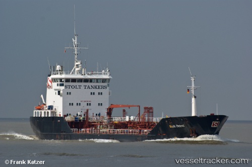
Vessel profile: Amazonit is a Chemical Oil Products Tanker with dimensions 15m x 96m.
This page combines live AIS, route history, probable destination signals, nearby traffic, and port activity for practical vessel monitoring.
The current position of vessel Amazonit is 44.34733 lat / 136.12132 lng. Updated: 2026-04-25 07:28:27 UTCNearest reference points:
- 37 nm SW of PLASTUN
- 33 nm NE of Ol'ga
- 30 nm S of Ol'ga
Currently sailing under the flag of Russia ![]()
Amazonit built in 1992 year
Deadweight:
4761 tDetails:
Live Vessel Amazonit Analytics (details, animations, etc.)
Recent AIS points (UTC):
2026-04-25 04:03:57 UTC · 43.76167, 135.57167 · SOG 12 kn · COG -1°2026-04-25 06:12:55 UTC · 44.14333, 135.89333 · SOG 12 kn · COG -1°
2026-04-25 07:18:57 UTC · 44.32167, 136.09167 · SOG 12 kn · COG -1°
2026-04-25 07:28:27 UTC · 44.34733, 136.12132 · SOG 12.5 kn · COG 40°