 vesseltracker.com
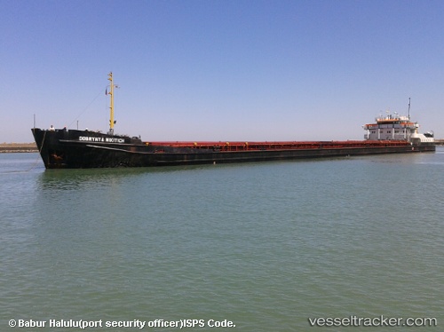
 DOBRYNYA NIKITICH
Current Status
Where is the vessel?
DOBRYNYA NIKITICH is currently in 76 nm W of Ban Talat Takua Pa, based on AIS data received about 113d ago.
Latest AIS update:
Current position: 8.74333° N, 97.08333° E (76 nm W of Ban Talat Takua Pa)
Average speed (last 7 days): Loading…
Average speed (last 30 days): Loading…
Vessel profile: DOBRYNYA NIKITICH is a General Cargo Ship with dimensions 16m x 138m.
This page combines live AIS, route history, probable destination signals, nearby traffic, and port activity for practical vessel monitoring.
The current position of vessel DOBRYNYA NIKITICH is 8.74333 lat / 97.08333 lng. Updated: 2026-01-21 09:11:11 UTCNearest reference points:
- 10 nm SW of Phuket International Apt
- Near Phuket International Apt
- Near Phuket Customs House
Currently sailing under the flag of Tanzania ![]()
DOBRYNYA NIKITICH built in 1970 year
Deadweight:
5180 tDetails:
Live Vessel DOBRYNYA NIKITICH Analytics (details, animations, etc.)
Recent AIS points (UTC):
2026-01-21 09:11:11 UTC · 8.74333, 97.08333 · SOG 4 kn · COG -1°