 vesseltracker.com
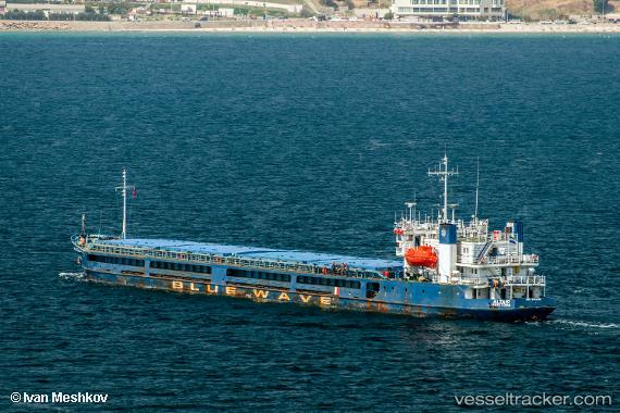
Altair
Current StatusWhere is the vessel?
Altair is currently in 18 nm NE of Cide, based on AIS data received about 3h ago.
Latest AIS update:
Current position: 42.07333° N, 33.31833° E (18 nm NE of Cide)
Average speed (last 7 days): Loading…
Average speed (last 30 days): Loading…
Vessel profile: Altair is a General Cargo Ship with dimensions 15m x 108m.
This page combines live AIS, route history, probable destination signals, nearby traffic, and port activity for practical vessel monitoring.
The current position of vessel Altair is 42.07333 lat / 33.31833 lng. Updated: 2026-03-28 02:01:04 UTCNearest reference points:
- 18 nm NW of INEBOLU
- 27 nm NW of INEBOLU
- Near Cide
Details:
Live Vessel Altair Analytics (details, animations, etc.)
Recent AIS points (UTC):
2026-03-27 22:07:00 UTC · 41.90500, 32.68333 · SOG 7 kn · COG -1°2026-03-28 00:01:04 UTC · 41.98667, 32.99500 · SOG 7 kn · COG -1°
2026-03-28 00:01:04 UTC · 41.98667, 32.99500 · SOG 7 kn · COG -1°
2026-03-28 02:01:04 UTC · 42.07333, 33.31833 · SOG 8 kn · COG -1°