 vesseltracker.com
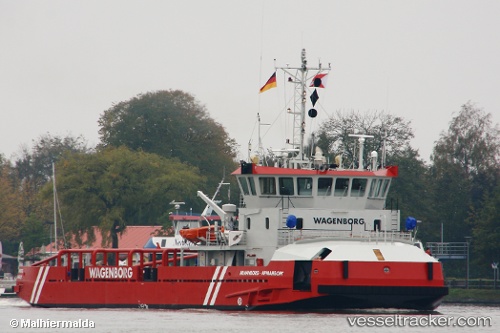
Armanborg
Current StatusWhere is the vessel?
Armanborg is currently in Near Bautino, based on AIS data received less than 1h ago.
Latest AIS update:
Current position: 44.54369° N, 50.25410° E (Near Bautino)
Average speed (last 7 days): Loading…
Average speed (last 30 days): Loading…
Vessel profile: Armanborg is a Offshore Tug Supply Ship with dimensions 13m x 45m.
This page combines live AIS, route history, probable destination signals, nearby traffic, and port activity for practical vessel monitoring.
The current position of vessel Armanborg is 44.54369 lat / 50.25410 lng. Updated: 2026-04-30 11:08:23 UTCNearest reference points:
- 53 nm W of Bautino
- 55 nm NW of Bautino
- 12 nm S of Aktau
Details:
Live Vessel Armanborg Analytics (details, animations, etc.)
Recent AIS points (UTC):
2026-04-30 07:35:22 UTC · 44.54369, 50.25411 · SOG 0 kn · COG -1°2026-04-30 07:44:23 UTC · 44.54369, 50.25410 · SOG 0 kn · COG -1°
2026-04-30 09:38:24 UTC · 44.54370, 50.25410 · SOG 0 kn · COG -1°
2026-04-30 11:08:23 UTC · 44.54369, 50.25410 · SOG 0 kn · COG -1°