 vesseltracker.com
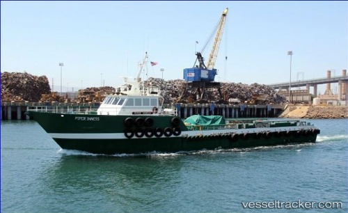
 Piper Inness
Current Status
Where is the vessel?
Piper Inness is currently in Near Long Beach, based on AIS data received less than 1h ago.
Latest AIS update:
Current position: 33.77087° N, 118.21171° W (Near Long Beach)
Average speed (last 7 days): Loading…
Average speed (last 30 days): Loading…
Vessel profile: Piper Inness is a Offshore Tug Supply Ship with dimensions 42m x 8m.
This page combines live AIS, route history, probable destination signals, nearby traffic, and port activity for practical vessel monitoring.
The current position of vessel Piper Inness is 33.77087 lat / -118.21171 lng. Updated: 2026-05-16 10:58:02 UTCNearest reference points:
- Near Long Beach
- Near Los Angeles
- Near Seal Beach
Currently sailing under the flag of USA ![]()
Details:
Live Vessel Piper Inness Analytics (details, animations, etc.)
Recent AIS points (UTC):
2026-05-16 07:21:49 UTC · 33.77085, -118.21177 · SOG 0 kn · COG -1°2026-05-16 08:18:10 UTC · 33.77084, -118.21173 · SOG 0 kn · COG -1°
2026-05-16 10:01:39 UTC · 33.77085, -118.21170 · SOG 0 kn · COG -1°
2026-05-16 10:58:02 UTC · 33.77087, -118.21171 · SOG 0 kn · COG -1°