 vesseltracker.com
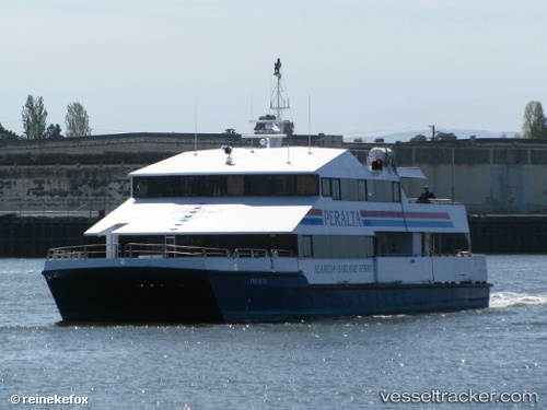
Peralta
Current StatusWhere is the vessel?
Peralta is currently in Near San Francisco, based on AIS data received about 1h ago.
Latest AIS update:
Current position: 37.79467° N, 122.39109° W (Near San Francisco)
Average speed (last 7 days): Loading…
Average speed (last 30 days): Loading…
Vessel profile: Peralta is a Passenger Ship with dimensions 10m x 33m.
This page combines live AIS, route history, probable destination signals, nearby traffic, and port activity for practical vessel monitoring.
The current position of vessel Peralta is 37.79467 lat / -122.39109 lng. Updated: 2026-05-16 18:04:25 UTCNearest reference points:
- Near San Francisco
- Near Treasure Island/Los Angeles
- Near Oakland
Details:
Live Vessel Peralta Analytics (details, animations, etc.)
Recent AIS points (UTC):
2026-05-16 04:18:25 UTC · 37.77136, -122.29945 · SOG 0 kn · COG 275°2026-05-16 16:04:11 UTC · 37.77140, -122.29947 · SOG 0 kn · COG 275°
2026-05-16 16:10:29 UTC · 37.77129, -122.29936 · SOG 0 kn · COG 274°
2026-05-16 18:04:25 UTC · 37.79467, -122.39109 · SOG 0 kn · COG 234°