 vesseltracker.com
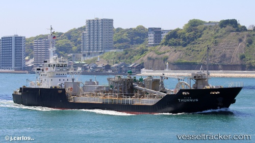
Thunnus
Current StatusWhere is the vessel?
Thunnus is currently in 20 nm W of SENZAKI, based on AIS data received about 1h ago.
Latest AIS update:
Current position: 34.33270° N, 130.80492° E (20 nm W of SENZAKI)
Average speed (last 7 days): Loading…
Average speed (last 30 days): Loading…
Vessel profile: Thunnus is a Pusher Tug with dimensions 14m x 74m.
This page combines live AIS, route history, probable destination signals, nearby traffic, and port activity for practical vessel monitoring.
The current position of vessel Thunnus is 34.33270 lat / 130.80492 lng. Updated: 2026-05-15 10:22:24 UTCNearest reference points:
- Near Hibikishinko
- Near Kokura
- Near KITAKYUSHU
Details:
Live Vessel Thunnus Analytics (details, animations, etc.)
Recent AIS points (UTC):
2026-05-15 07:03:43 UTC · 34.65233, 131.47055 · SOG 11.9 kn · COG 247°2026-05-15 07:48:35 UTC · 34.59370, 131.30634 · SOG 11.7 kn · COG 246°
2026-05-15 09:50:25 UTC · 34.41167, 130.87062 · SOG 12.2 kn · COG 228°
2026-05-15 10:22:24 UTC · 34.33270, 130.80492 · SOG 11.4 kn · COG 170°