 vesseltracker.com
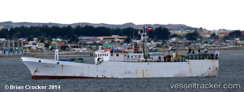
Sunstar
Current StatusWhere is the vessel?
Sunstar is currently in 224 nm SE of Bahia San Blas, based on AIS data received about 1h ago.
Latest AIS update:
Current position: 42.92865° S, 58.40173° W (224 nm SE of Bahia San Blas)
Average speed (last 7 days): Loading…
Average speed (last 30 days): Loading…
Vessel profile: Sunstar is a Fishing Vessel with dimensions 10m x 60m.
This page combines live AIS, route history, probable destination signals, nearby traffic, and port activity for practical vessel monitoring.
The current position of vessel Sunstar is -42.92865 lat / -58.40173 lng. Updated: 2026-05-16 17:25:18 UTCNearest reference points:
- 186 nm S of Quequen
Details:
Live Vessel Sunstar Analytics (details, animations, etc.)
Recent AIS points (UTC):
2026-05-16 13:16:52 UTC · -43.28710, -58.69513 · SOG 6 kn · COG 199°2026-05-16 15:31:27 UTC · -43.07790, -58.66810 · SOG 11.8 kn · COG 55°
2026-05-16 16:26:08 UTC · -42.96448, -58.48004 · SOG 12 kn · COG 54°
2026-05-16 17:25:18 UTC · -42.92865, -58.40173 · SOG 1 kn · COG 240°