 vesseltracker.com
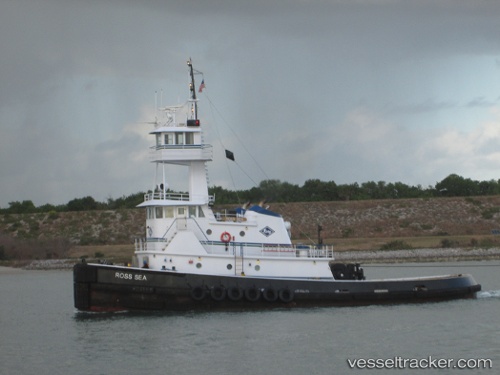
 Ross Sea
Current Status
Where is the vessel?
Ross Sea is currently in Near Earleville, based on AIS data received less than 1h ago.
Latest AIS update:
Current position: 39.46651° N, 75.96993° W (Near Earleville)
Average speed (last 7 days): Loading…
Average speed (last 30 days): Loading…
Vessel profile: Ross Sea is a Tug with dimensions 30m x 112m.
This page combines live AIS, route history, probable destination signals, nearby traffic, and port activity for practical vessel monitoring.
The current position of vessel Ross Sea is 39.46651 lat / -75.96993 lng. Updated: 2026-05-14 14:15:16 UTCNearest reference points:
- Near Chesapeake City
- Near Wilmington
- Near DUNDALK
Currently sailing under the flag of USA ![]()
Ross Sea built in 2003 year
Deadweight:
180 tDetails:
Live Vessel Ross Sea Analytics (details, animations, etc.)
Recent AIS points (UTC):
2026-05-14 10:32:38 UTC · 39.58022, -75.55557 · SOG 5.7 kn · COG 155°2026-05-14 11:28:37 UTC · 39.55519, -75.63397 · SOG 5.2 kn · COG 275°
2026-05-14 13:38:56 UTC · 39.50961, -75.89781 · SOG 6.9 kn · COG 248°
2026-05-14 14:15:16 UTC · 39.46651, -75.96993 · SOG 7.4 kn · COG 222°