 vesseltracker.com
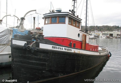
Briana Marie
Current StatusWhere is the vessel?
Briana Marie is currently in Near Golden Meadow, based on AIS data received less than 1h ago.
Latest AIS update:
Current position: 29.35701° N, 90.25104° W (Near Golden Meadow)
Average speed (last 7 days): Loading…
Average speed (last 30 days): Loading…
Vessel profile: Briana Marie is a Offshore Tug Supply Ship with dimensions 10m x 42m.
This page combines live AIS, route history, probable destination signals, nearby traffic, and port activity for practical vessel monitoring.
The current position of vessel Briana Marie is 29.35701 lat / -90.25104 lng. Updated: 2026-05-14 10:09:37 UTCNearest reference points:
- Near FOURCHON
- Near Port Fourchon
- Near HOUMA
Details:
Live Vessel Briana Marie Analytics (details, animations, etc.)
Recent AIS points (UTC):
2026-05-14 06:39:38 UTC · 29.35700, -90.25101 · SOG 0 kn · COG -1°2026-05-14 07:03:37 UTC · 29.35700, -90.25106 · SOG 0 kn · COG -1°
2026-05-14 08:12:38 UTC · 29.35701, -90.25104 · SOG 0 kn · COG -1°
2026-05-14 10:09:37 UTC · 29.35701, -90.25104 · SOG 0 kn · COG -1°