 vesseltracker.com
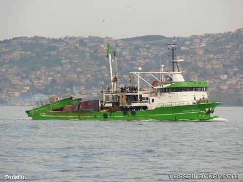
 Cinar Ibrahim
Current Status
Where is the vessel?
Cinar Ibrahim is currently in 21 nm NE of Damietta, based on AIS data received about 2h ago.
Latest AIS update:
Current position: 31.67333° N, 32.10167° E (21 nm NE of Damietta)
Average speed (last 7 days): Loading…
Average speed (last 30 days): Loading…
Vessel profile: Cinar Ibrahim is a Fishing Vessel with dimensions 48m x 18m.
This page combines live AIS, route history, probable destination signals, nearby traffic, and port activity for practical vessel monitoring.
The current position of vessel Cinar Ibrahim is 31.67333 lat / 32.10167 lng. Updated: 2026-05-15 19:25:27 UTCNearest reference points:
- 21 nm N of Port Said
- 15 nm N of Port Said
- 16 nm N of Port Said
Currently sailing under the flag of Turkey ![]()
Details:
Live Vessel Cinar Ibrahim Analytics (details, animations, etc.)
Recent AIS points (UTC):
2026-05-15 17:06:00 UTC · 31.46437, 32.35636 · SOG 8.7 kn · COG -1°2026-05-15 17:55:26 UTC · 31.52667, 32.25667 · SOG 4 kn · COG -1°
2026-05-15 19:16:25 UTC · 31.65667, 32.11667 · SOG 7 kn · COG -1°
2026-05-15 19:25:27 UTC · 31.67333, 32.10167 · SOG 8 kn · COG -1°