 vesseltracker.com
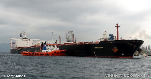
Navarino
Current StatusWhere is the vessel?
Navarino is currently in 14 nm E of Polsbroek, based on AIS data received about 108d ago.
Latest AIS update:
Current position: 51.93965° N, 45.52918° E (14 nm E of Polsbroek)
Average speed (last 7 days): Loading…
Average speed (last 30 days): Loading…
Vessel profile: Navarino is a Crude Oil Tanker with dimensions 44m x 274m.
This page combines live AIS, route history, probable destination signals, nearby traffic, and port activity for practical vessel monitoring.
The current position of vessel Navarino is 51.93965 lat / 45.52918 lng. Updated: 2026-01-12 06:07:16 UTCNearest reference points:
- Near Engels
- 15 nm NW of Sennoy
- Near Kamyshin
Details:
Live Vessel Navarino Analytics (details, animations, etc.)
Recent AIS points (UTC):
2026-01-12 06:07:16 UTC · 51.93965, 45.52918 · SOG 7.2 kn · COG 64°