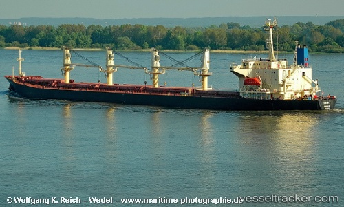
 SAMANTA
Current Status
Where is the vessel?
SAMANTA is currently in 36 nm SW of Dayyer, based on AIS data received about 15h ago.
Latest AIS update:
Current position: 27.56304° N, 51.32752° E (36 nm SW of Dayyer)
Average speed (last 7 days): Loading…
Average speed (last 30 days): Loading…
Vessel profile: SAMANTA is a Bulk Carrier with dimensions m x m.
This page combines live AIS, route history, probable destination signals, nearby traffic, and port activity for practical vessel monitoring.
The current position of vessel SAMANTA is 27.56304 lat / 51.32752 lng. Updated: 2026-05-24 07:28:57 UTCNearest reference points:
- Near Dayyer
- Near Sarooj Anchorage
- Near ASALUYEH
Currently sailing under the flag of Saint Kitts and Nevis ![]()
Details:
Live Vessel SAMANTA Analytics (details, animations, etc.)
Recent AIS points (UTC):
2026-05-24 05:03:47 UTC · 27.70727, 51.00039 · SOG 8.5 kn · COG 115°2026-05-24 06:09:09 UTC · 27.64098, 51.15068 · SOG 7.9 kn · COG 117°
2026-05-24 07:24:17 UTC · 27.56754, 51.31704 · SOG 7.9 kn · COG 115°
2026-05-24 07:28:57 UTC · 27.56304, 51.32752 · SOG 7.9 kn · COG 115°