 vesseltracker.com
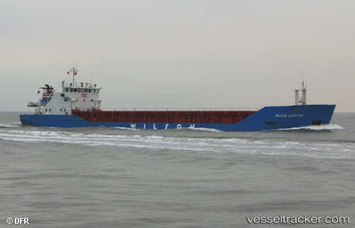
 ANNIKA
Current Status
Where is the vessel?
ANNIKA is currently in Near Olkiluoto, based on AIS data received about 1h ago.
Latest AIS update:
Current position: 61.24871° N, 21.48904° E (Near Olkiluoto)
Average speed (last 7 days): Loading…
Average speed (last 30 days): Loading…
Vessel profile: ANNIKA is a General Cargo with dimensions m x m.
This page combines live AIS, route history, probable destination signals, nearby traffic, and port activity for practical vessel monitoring.
The current position of vessel ANNIKA is 61.24871 lat / 21.48904 lng. Updated: 2026-05-13 02:17:09 UTCNearest reference points:
- Near Rouhu
- Near Pansio
- Near Turku
Currently sailing under the flag of Finland ![]()
Details:
Live Vessel ANNIKA Analytics (details, animations, etc.)
Recent AIS points (UTC):
2026-05-12 22:30:00 UTC · 61.13699, 21.18513 · SOG 9 kn · COG 18°2026-05-12 23:36:50 UTC · 61.28895, 21.29865 · SOG 9 kn · COG 57°
2026-05-13 01:29:10 UTC · 61.24869, 21.48903 · SOG 0 kn · COG 172°
2026-05-13 02:17:09 UTC · 61.24871, 21.48904 · SOG 0 kn · COG 172°