 vesseltracker.com
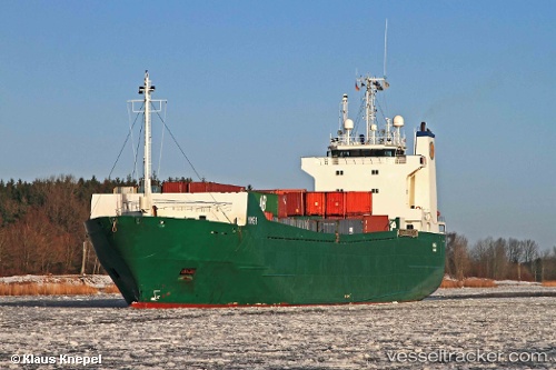
 Mimer
Mimer
Current Status
Where is the vessel?
Mimer is currently in 48 nm S of Port St. Louis Du Rhone, based on AIS data received less than 1h ago.
Latest AIS update:
Current position: 42.60667° N, 4.58167° E (48 nm S of Port St. Louis Du Rhone)
Average speed (last 7 days): Loading…
Average speed (last 30 days): Loading…
Vessel profile: Mimer is a Ro Ro Cargo Ship with dimensions 108m x 17m.
This page combines live AIS, route history, probable destination signals, nearby traffic, and port activity for practical vessel monitoring.
The current position of vessel Mimer is 42.60667 lat / 4.58167 lng. Updated: 2026-05-14 19:48:57 UTCNearest reference points:
- 25 nm SW of Carro
- 23 nm SW of Toulon
- Near SAINT LOUIS DU RHONE
Currently sailing under the flag of Finland ![]()
Mimer built in 1990 year
Deadweight:
4232 tDetails:
Live Vessel Mimer Analytics (details, animations, etc.)
Recent AIS points (UTC):
2026-05-14 16:17:51 UTC · 43.20898, 5.15163 · SOG 12.7 kn · COG 218°2026-05-14 17:25:01 UTC · 43.01414, 4.98578 · SOG 12.4 kn · COG 217°
2026-05-14 19:35:46 UTC · 42.64462, 4.61771 · SOG 12.6 kn · COG 216°
2026-05-14 19:48:57 UTC · 42.60667, 4.58167 · SOG 12 kn · COG -1°