 vesseltracker.com
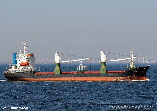
 Maria
Maria
Current Status
Where is the vessel?
Maria is currently in 36 nm NE of Lü-hua Shan, based on AIS data received less than 1h ago.
Latest AIS update:
Current position: 31.17857° N, 123.17743° E (36 nm NE of Lü-hua Shan)
Average speed (last 7 days): Loading…
Average speed (last 30 days): Loading…
Vessel profile: Maria is a General Cargo Ship with dimensions 111m x 18m.
This page combines live AIS, route history, probable destination signals, nearby traffic, and port activity for practical vessel monitoring.
The current position of vessel Maria is 31.17857 lat / 123.17743 lng. Updated: 2026-05-15 13:12:46 UTCNearest reference points:
- 21 nm NE of Lü-hua Shan
- 19 nm NE of Lü-hua Shan
- 44 nm E of Lü-hua Shan
Currently sailing under the flag of Togo ![]()
Maria built in 1992 year
Deadweight:
6280 tDetails:
Live Vessel Maria Analytics (details, animations, etc.)
Recent AIS points (UTC):
2026-05-15 09:00:36 UTC · 31.17730, 123.17740 · SOG 0 kn · COG 52°2026-05-15 09:00:36 UTC · 31.17730, 123.17740 · SOG 0 kn · COG 52°
2026-05-15 09:00:36 UTC · 31.17730, 123.17740 · SOG 0 kn · COG 52°
2026-05-15 13:12:46 UTC · 31.17857, 123.17743 · SOG 0.4 kn · COG 122°