 vesseltracker.com
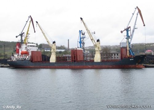
 PARESA
Current Status
Where is the vessel?
PARESA is currently in Near MISURATA, based on AIS data received about 1h ago.
Latest AIS update:
Current position: 32.39468° N, 15.27196° E (Near MISURATA)
Average speed (last 7 days): Loading…
Average speed (last 30 days): Loading…
Vessel profile: PARESA is a General Cargo with dimensions m x m.
This page combines live AIS, route history, probable destination signals, nearby traffic, and port activity for practical vessel monitoring.
The current position of vessel PARESA is 32.39468 lat / 15.27196 lng. Updated: 2026-05-02 16:24:56 UTCNearest reference points:
- Near MISURATA
- 22 nm NW of Tarabulus
Currently sailing under the flag of Sierra Leone ![]()
Details:
Live Vessel PARESA Analytics (details, animations, etc.)
Recent AIS points (UTC):
2026-05-02 13:21:57 UTC · 32.39495, 15.27148 · SOG 0.2 kn · COG 40°2026-05-02 13:30:56 UTC · 32.39474, 15.27201 · SOG 0.2 kn · COG 26°
2026-05-02 16:06:56 UTC · 32.39482, 15.27173 · SOG 0.3 kn · COG 35°
2026-05-02 16:24:56 UTC · 32.39468, 15.27196 · SOG 1.1 kn · COG 16°