 vesseltracker.com
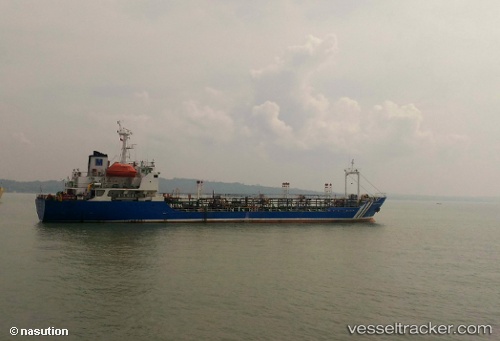
Mt.maxima Pratama
Current StatusWhere is the vessel?
Mt.maxima Pratama is currently in Near LAMONGAN, based on AIS data received less than 1h ago.
Latest AIS update:
Current position: 6.85123° S, 112.42636° E (Near LAMONGAN)
Average speed (last 7 days): Loading…
Average speed (last 30 days): Loading…
Vessel profile: Mt.maxima Pratama is a Chemical Tanker with dimensions 15m x 83m.
This page combines live AIS, route history, probable destination signals, nearby traffic, and port activity for practical vessel monitoring.
The current position of vessel Mt.maxima Pratama is -6.85123 lat / 112.42636 lng. Updated: 2026-04-30 22:13:22 UTCNearest reference points:
- Near LAMONGAN
- Near Bangkalan
- Near GRESIK
Details:
Live Vessel Mt.maxima Pratama Analytics (details, animations, etc.)
Recent AIS points (UTC):
2026-04-30 19:31:42 UTC · -6.85147, 112.42670 · SOG 0.4 kn · COG -1°2026-04-30 19:59:33 UTC · -6.85128, 112.42650 · SOG 0.1 kn · COG -1°
2026-04-30 21:39:33 UTC · -6.85138, 112.42661 · SOG 0 kn · COG -1°
2026-04-30 22:13:22 UTC · -6.85123, 112.42636 · SOG 0 kn · COG -1°