 vesseltracker.com
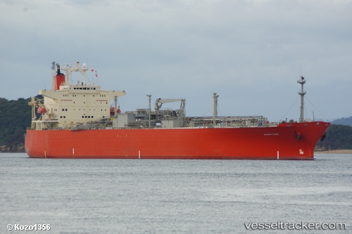
 FOGAS
FOGAS
Current Status
Where is the vessel?
FOGAS is currently in 17 nm NE of MASIRAH, based on AIS data received less than 1h ago.
Latest AIS update:
Current position: 20.85908° N, 59.08939° E (17 nm NE of MASIRAH)
Average speed (last 7 days): Loading…
Average speed (last 30 days): Loading…
Vessel profile: FOGAS is a Lpg Tanker with dimensions m x m.
This page combines live AIS, route history, probable destination signals, nearby traffic, and port activity for practical vessel monitoring.
The current position of vessel FOGAS is 20.85908 lat / 59.08939 lng. Updated: 2026-05-14 21:10:52 UTCNearest reference points:
- Near AL DUQM
- Near Duqm
- 90 nm SE of SUR
Currently sailing under the flag of Angola ![]()
Details:
Live Vessel FOGAS Analytics (details, animations, etc.)
Recent AIS points (UTC):
2026-05-14 17:45:43 UTC · 20.85927, 59.08909 · SOG 0.1 kn · COG -1°2026-05-14 19:12:42 UTC · 20.85920, 59.08941 · SOG 0.1 kn · COG -1°
2026-05-14 20:06:47 UTC · 20.85907, 59.08931 · SOG 0 kn · COG -1°
2026-05-14 21:10:52 UTC · 20.85908, 59.08939 · SOG 0.1 kn · COG -1°