 vesseltracker.com
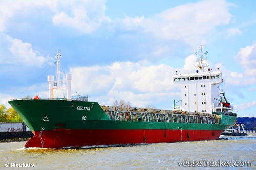
 Celina
Current Status
Where is the vessel?
Celina is currently in Near Cimdenieki, based on AIS data received about 1h ago.
Latest AIS update:
Current position: 56.54324° N, 21.04053° E (Near Cimdenieki)
Average speed (last 7 days): Loading…
Average speed (last 30 days): Loading…
Vessel profile: Celina is a Multi Purpose Carrier with dimensions 105m x 16m.
This page combines live AIS, route history, probable destination signals, nearby traffic, and port activity for practical vessel monitoring.
The current position of vessel Celina is 56.54324 lat / 21.04053 lng. Updated: 2026-05-15 11:40:13 UTCNearest reference points:
- Near Cimdenieki
- Near Klaipeda
- Near Ventspils
Currently sailing under the flag of Antigua Barbuda ![]()
Celina built in 2001 year
Deadweight:
5657 tDetails:
Live Vessel Celina Analytics (details, animations, etc.)
Recent AIS points (UTC):
2026-05-15 07:52:15 UTC · 56.54326, 21.04054 · SOG 0 kn · COG -1°2026-05-15 09:37:14 UTC · 56.54328, 21.04054 · SOG 0 kn · COG -1°
2026-05-15 10:28:14 UTC · 56.54330, 21.04053 · SOG 0 kn · COG -1°
2026-05-15 11:40:13 UTC · 56.54324, 21.04053 · SOG 0 kn · COG -1°