 vesseltracker.com
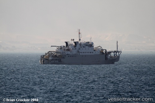
Teneo
Current StatusWhere is the vessel?
Teneo is currently in 25 nm N of Wainibe, based on AIS data received about 19h ago.
Latest AIS update:
Current position: 2.64500° S, 126.54833° E (25 nm N of Wainibe)
Average speed (last 7 days): Loading…
Average speed (last 30 days): Loading…
Vessel profile: Teneo is a Cable Layer with dimensions 14m x 80m.
This page combines live AIS, route history, probable destination signals, nearby traffic, and port activity for practical vessel monitoring.
The current position of vessel Teneo is -2.64500 lat / 126.54833 lng. Updated: 2026-05-17 07:40:15 UTCNearest reference points:
- 69 nm NW of Wainibe
- 55 nm S of Labuha, Molucas
- Near Ambon
Details:
Live Vessel Teneo Analytics (details, animations, etc.)
Recent AIS points (UTC):
2026-05-15 23:47:53 UTC · 0.14167, 129.11833 · SOG 0 kn · COG -1°2026-05-17 07:40:15 UTC · -2.64500, 126.54833 · SOG 9 kn · COG -1°
2026-05-17 07:40:15 UTC · -2.64500, 126.54833 · SOG 9 kn · COG -1°
2026-05-17 07:40:15 UTC · -2.64500, 126.54833 · SOG 9 kn · COG -1°