 vesseltracker.com
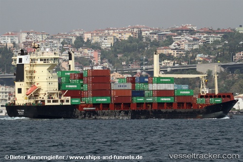
 Inga A
Current Status
Where is the vessel?
Inga A is currently in 27 nm W of Saint Lawrence, based on AIS data received about 304d ago.
Latest AIS update:
Current position: 35.86691° N, 13.68992° E (27 nm W of Saint Lawrence)
Average speed (last 7 days): Loading…
Average speed (last 30 days): Loading…
Vessel profile: Inga A is a Container Ship with dimensions 149m x 22m.
This page combines live AIS, route history, probable destination signals, nearby traffic, and port activity for practical vessel monitoring.
The current position of vessel Inga A is 35.86691 lat / 13.68992 lng. Updated: 2025-07-13 17:36:57 UTCNearest reference points:
- Near CIRKEWWA
- Near Sliema
- Near Saint Julians
Currently sailing under the flag of Panama ![]()
Inga A built in 1993 year
Deadweight:
12184 tDetails:
Live Vessel Inga A Analytics (details, animations, etc.)
Recent AIS points (UTC):
2025-07-13 17:36:57 UTC · 35.86691, 13.68992 · SOG 0.4 kn · COG 116°