 vesseltracker.com
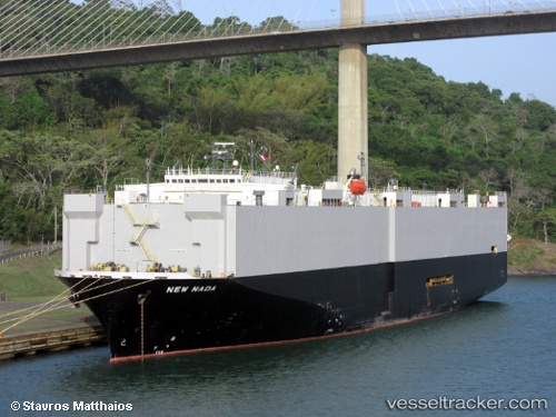
New Nada
Current StatusWhere is the vessel?
New Nada is currently in Near TANAH MERAH, based on AIS data received less than 1h ago.
Latest AIS update:
Current position: 1.24989° N, 104.07931° E (Near TANAH MERAH)
Average speed (last 7 days): Loading…
Average speed (last 30 days): Loading…
Vessel profile: New Nada is a Vehicles Carrier with dimensions 32m x 180m.
This page combines live AIS, route history, probable destination signals, nearby traffic, and port activity for practical vessel monitoring.
The current position of vessel New Nada is 1.24989 lat / 104.07931 lng. Updated: 2026-05-15 14:03:30 UTCNearest reference points:
- Near TANAH MERAH
- Near BATU AMPAR
- Near Changi
Details:
Live Vessel New Nada Analytics (details, animations, etc.)
Recent AIS points (UTC):
2026-05-15 11:02:05 UTC · 1.14661, 103.47699 · SOG 13.6 kn · COG 121°2026-05-15 11:37:21 UTC · 1.07561, 103.59197 · SOG 13.8 kn · COG 125°
2026-05-15 13:24:42 UTC · 1.21991, 103.93278 · SOG 13.8 kn · COG 65°
2026-05-15 14:03:30 UTC · 1.24989, 104.07931 · SOG 14 kn · COG 79°