 vesseltracker.com
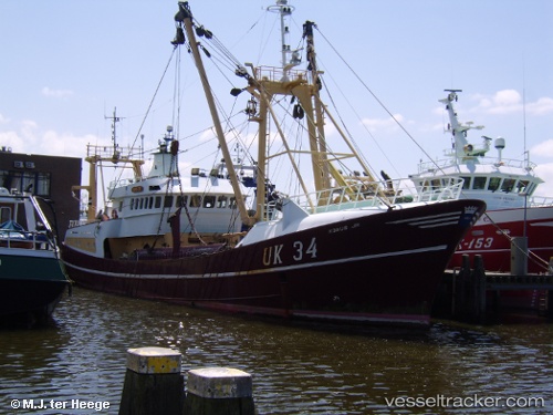
 Uk34 Kobus Jr
Current Status
Where is the vessel?
Uk34 Kobus Jr is currently in 31 nm W of HVIDE SANDE, based on AIS data received about 1h ago.
Latest AIS update:
Current position: 55.87167° N, 7.22333° E (31 nm W of HVIDE SANDE)
Average speed (last 7 days): Loading…
Average speed (last 30 days): Loading…
Vessel profile: Uk34 Kobus Jr is a Fishing Vessel with dimensions 40m x 8m.
This page combines live AIS, route history, probable destination signals, nearby traffic, and port activity for practical vessel monitoring.
The current position of vessel Uk34 Kobus Jr is 55.87167 lat / 7.22333 lng. Updated: 2026-05-14 11:35:57 UTCNearest reference points:
- 36 nm W of HVIDE SANDE
- Near Blavand
- Near Fanoe
Currently sailing under the flag of Netherlands ![]()
Uk34 Kobus Jr built in 1992 year
Deadweight:
150 tDetails:
Live Vessel Uk34 Kobus Jr Analytics (details, animations, etc.)
Recent AIS points (UTC):
2026-05-14 08:23:55 UTC · 55.94167, 7.23500 · SOG 6 kn · COG -1°2026-05-14 10:13:42 UTC · 55.83691, 7.15604 · SOG 6.2 kn · COG 229°
2026-05-14 10:35:15 UTC · 55.80682, 7.12134 · SOG 6.2 kn · COG 144°
2026-05-14 11:35:57 UTC · 55.87167, 7.22333 · SOG 0 kn · COG -1°