 vesseltracker.com
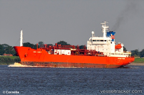
 G SPRING
Current Status
Where is the vessel?
G SPRING is currently in 50 nm SE of Lü-hua Shan, based on AIS data received about 1h ago.
Latest AIS update:
Current position: 30.19560° N, 123.27336° E (50 nm SE of Lü-hua Shan)
Average speed (last 7 days): Loading…
Average speed (last 30 days): Loading…
Vessel profile: G SPRING is a Lpg Tanker with dimensions m x m.
This page combines live AIS, route history, probable destination signals, nearby traffic, and port activity for practical vessel monitoring.
The current position of vessel G SPRING is 30.19560 lat / 123.27336 lng. Updated: 2026-05-16 12:04:29 UTCNearest reference points:
- 50 nm SE of Lü-hua Shan
- 57 nm SE of Lü-hua Shan
- 45 nm E of JINHAI HEAVY INDUSTR
Currently sailing under the flag of Mongolia ![]()
Details:
Live Vessel G SPRING Analytics (details, animations, etc.)
Recent AIS points (UTC):
2026-05-16 07:43:29 UTC · 30.19155, 123.27333 · SOG 0.2 kn · COG 39°2026-05-16 09:25:26 UTC · 30.19325, 123.27188 · SOG 0.1 kn · COG 105°
2026-05-16 10:40:25 UTC · 30.19487, 123.27238 · SOG 0.2 kn · COG 132°
2026-05-16 12:04:29 UTC · 30.19560, 123.27336 · SOG 0.1 kn · COG 148°