 vesseltracker.com
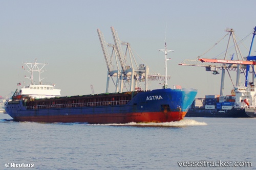
 A S T R A
Current Status
Where is the vessel?
A S T R A is currently in Near Brake, based on AIS data received less than 1h ago.
Latest AIS update:
Current position: 53.35483° N, 8.49751° E (Near Brake)
Average speed (last 7 days): Loading…
Average speed (last 30 days): Loading…
Vessel profile: A S T R A is a Multi Purpose Carrier with dimensions 85m x 13m.
This page combines live AIS, route history, probable destination signals, nearby traffic, and port activity for practical vessel monitoring.
The current position of vessel A S T R A is 53.35483 lat / 8.49751 lng. Updated: 2026-05-15 10:16:23 UTCNearest reference points:
- Near Sandstedt
- Near Brake
- Near Bremerhaven
Currently sailing under the flag of Antigua Barbuda ![]()
A S T R A built in 1993 year
Deadweight:
3582 tDetails:
Live Vessel A S T R A Analytics (details, animations, etc.)
Recent AIS points (UTC):
2026-05-15 07:07:27 UTC · 53.35485, 8.49751 · SOG 0 kn · COG 176°2026-05-15 07:37:25 UTC · 53.35484, 8.49750 · SOG 0 kn · COG 176°
2026-05-15 10:01:24 UTC · 53.35485, 8.49751 · SOG 0 kn · COG 176°
2026-05-15 10:16:23 UTC · 53.35483, 8.49751 · SOG 0 kn · COG 176°