 vesseltracker.com
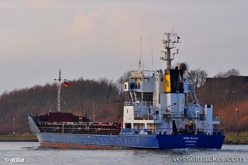
 AGAETE
Current Status
Where is the vessel?
AGAETE is currently in Near Cimdenieki, based on AIS data received less than 1h ago.
Latest AIS update:
Current position: 56.52055° N, 20.99798° E (Near Cimdenieki)
Average speed (last 7 days): Loading…
Average speed (last 30 days): Loading…
Vessel profile: AGAETE is a General Cargo Ship with dimensions 87m x 87m.
This page combines live AIS, route history, probable destination signals, nearby traffic, and port activity for practical vessel monitoring.
The current position of vessel AGAETE is 56.52055 lat / 20.99798 lng. Updated: 2026-05-14 05:58:13 UTCNearest reference points:
- Near Cimdenieki
- Near Klaipeda
- Near Ventspils
Currently sailing under the flag of Antigua and Barbuda ![]()
AGAETE built in 1991 year
Deadweight:
3269 tDetails:
Live Vessel AGAETE Analytics (details, animations, etc.)
Recent AIS points (UTC):
2026-05-14 02:10:17 UTC · 56.52055, 20.99798 · SOG 0 kn · COG 58°2026-05-14 03:52:15 UTC · 56.52053, 20.99798 · SOG 0 kn · COG 58°
2026-05-14 05:04:15 UTC · 56.52055, 20.99798 · SOG 0 kn · COG 58°
2026-05-14 05:58:13 UTC · 56.52055, 20.99798 · SOG 0 kn · COG 58°