 vesseltracker.com
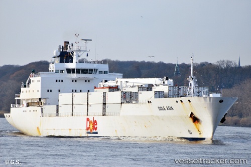
 Dole Asia
Current Status
Where is the vessel?
Dole Asia is currently in 88 nm S of Barahona, based on AIS data received about 2h ago.
Latest AIS update:
Current position: 16.76191° N, 70.77497° W (88 nm S of Barahona)
Average speed (last 7 days): Loading…
Average speed (last 30 days): Loading…
Vessel profile: Dole Asia is a Refrigerated Cargo Ship with dimensions 150m x 22m.
This page combines live AIS, route history, probable destination signals, nearby traffic, and port activity for practical vessel monitoring.
The current position of vessel Dole Asia is 16.76191 lat / -70.77497 lng. Updated: 2026-05-14 23:23:54 UTCNearest reference points:
- Near Bahia De Las Calderas
- Near CASA DE CAMPO
- 148 nm N of Dorp Rincón
Currently sailing under the flag of Bahamas ![]()
Details:
Live Vessel Dole Asia Analytics (details, animations, etc.)
Recent AIS points (UTC):
2026-05-14 19:45:17 UTC · 16.25194, -71.71123 · SOG 16.5 kn · COG 63°2026-05-14 21:43:58 UTC · 16.52788, -71.20585 · SOG 17.1 kn · COG 61°
2026-05-14 23:09:25 UTC · 16.72811, -70.83726 · SOG 16.7 kn · COG 66°
2026-05-14 23:23:54 UTC · 16.76191, -70.77497 · SOG 17 kn · COG 64°