 vesseltracker.com
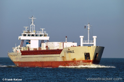
 Cemvale
Current Status
Where is the vessel?
Cemvale is currently in Near Portpatrick, based on AIS data received less than 1h ago.
Latest AIS update:
Current position: 54.87887° N, 5.28539° W (Near Portpatrick)
Average speed (last 7 days): Loading…
Average speed (last 30 days): Loading…
Vessel profile: Cemvale is a Cement Carrier with dimensions 88m x 14m.
This page combines live AIS, route history, probable destination signals, nearby traffic, and port activity for practical vessel monitoring.
The current position of vessel Cemvale is 54.87887 lat / -5.28539 lng. Updated: 2026-05-13 04:03:52 UTCNearest reference points:
- Near Turnberry
- Near Girvan
- Near Belfast
Currently sailing under the flag of Cyprus ![]()
Cemvale built in 1992 year
Deadweight:
4257 tDetails:
Live Vessel Cemvale Analytics (details, animations, etc.)
Recent AIS points (UTC):
2026-05-13 01:08:23 UTC · 55.39317, -4.96967 · SOG 11.3 kn · COG 180°2026-05-13 02:26:43 UTC · 55.17239, -5.12165 · SOG 11 kn · COG 211°
2026-05-13 03:34:43 UTC · 54.98238, -5.28438 · SOG 12.1 kn · COG 182°
2026-05-13 04:03:52 UTC · 54.87887, -5.28539 · SOG 13 kn · COG 183°