 vesseltracker.com
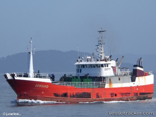
Seifjord
Current StatusWhere is the vessel?
Seifjord is currently in Near CALBUCO SAN JOSE, based on AIS data received about 9d ago.
Latest AIS update:
Current position: 41.79167° S, 73.20667° W (Near CALBUCO SAN JOSE)
Average speed (last 7 days): Loading…
Average speed (last 30 days): Loading…
Vessel profile: Seifjord is a Fish Carrier with dimensions 10m x 48m.
This page combines live AIS, route history, probable destination signals, nearby traffic, and port activity for practical vessel monitoring.
The current position of vessel Seifjord is -41.79167 lat / -73.20667 lng. Updated: 2026-05-04 19:10:12 UTCNearest reference points:
- Near Puerto Montt
- Near Chonchi
- Near Quellón (Puerto Quellón)
Details:
Live Vessel Seifjord Analytics (details, animations, etc.)
Recent AIS points (UTC):
2026-05-04 19:10:12 UTC · -41.79167, -73.20667 · SOG 0 kn · COG -1°2026-05-04 19:10:12 UTC · -41.79167, -73.20667 · SOG 0 kn · COG -1°
2026-05-04 19:10:12 UTC · -41.79167, -73.20667 · SOG 0 kn · COG -1°
2026-05-04 19:10:12 UTC · -41.79167, -73.20667 · SOG 0 kn · COG -1°
2026-05-04 19:10:12 UTC · -41.79167, -73.20667 · SOG 0 kn · COG -1°