 vesseltracker.com
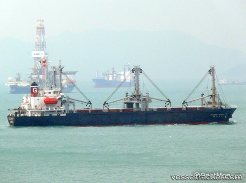
 SA HYANG SAN 1
Current Status
Where is the vessel?
SA HYANG SAN 1 is currently in Near Chinnampo, based on AIS data received about 3h ago.
Latest AIS update:
Current position: 38.69065° N, 125.25892° E (Near Chinnampo)
Average speed (last 7 days): Loading…
Average speed (last 30 days): Loading…
Vessel profile: SA HYANG SAN 1 is a General Cargo Ship with dimensions 60m x 328m.
This page combines live AIS, route history, probable destination signals, nearby traffic, and port activity for practical vessel monitoring.
The current position of vessel SA HYANG SAN 1 is 38.69065 lat / 125.25892 lng. Updated: 2026-05-13 16:39:36 UTCNearest reference points:
- Near Chinnampo
- 12 nm N of Panjang
- Near Kyomipo
Currently sailing under the flag of Korea Democratic Republic ![]()
SA HYANG SAN 1 built in 1992 year
Deadweight:
5849 tDetails:
Live Vessel SA HYANG SAN 1 Analytics (details, animations, etc.)
Recent AIS points (UTC):
2026-05-13 15:30:39 UTC · 38.69073, 125.25891 · SOG 0 kn · COG -1°2026-05-13 16:39:36 UTC · 38.69065, 125.25892 · SOG 0 kn · COG -1°
2026-05-13 16:39:36 UTC · 38.69065, 125.25892 · SOG 0 kn · COG -1°
2026-05-13 16:39:36 UTC · 38.69065, 125.25892 · SOG 0 kn · COG -1°