 vesseltracker.com
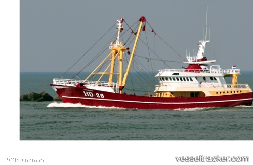
 Hd29 Morgenster
Current Status
Where is the vessel?
Hd29 Morgenster is currently in Near Glesvær, based on AIS data received about 1h ago.
Latest AIS update:
Current position: 60.15619° N, 4.95934° E (Near Glesvær)
Average speed (last 7 days): Loading…
Average speed (last 30 days): Loading…
Vessel profile: Hd29 Morgenster is a Fishing Vessel with dimensions 44m x 9m.
This page combines live AIS, route history, probable destination signals, nearby traffic, and port activity for practical vessel monitoring.
The current position of vessel Hd29 Morgenster is 60.15619 lat / 4.95934 lng. Updated: 2026-04-09 01:33:34 UTCNearest reference points:
- Near Glesvær
- Near TORANGSVAG
- Near Hakonsvern
Currently sailing under the flag of Netherlands ![]()
Hd29 Morgenster built in 1993 year
Details:
Live Vessel Hd29 Morgenster Analytics (details, animations, etc.)
Recent AIS points (UTC):
2026-04-08 17:40:28 UTC · 59.40002, 5.26382 · SOG 0 kn · COG 303°2026-04-08 19:21:47 UTC · 59.44792, 5.22581 · SOG 10.1 kn · COG 351°
2026-04-08 23:37:38 UTC · 60.04762, 5.32853 · SOG 10.5 kn · COG 355°
2026-04-09 01:33:34 UTC · 60.15619, 4.95934 · SOG 7.7 kn · COG 301°