 vesseltracker.com
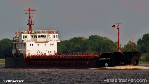
 Anka
Anka
Current Status
Where is the vessel?
Anka is currently in 11 nm E of Banana, based on AIS data received less than 1h ago.
Latest AIS update:
Current position: 6.03415° S, 12.55875° E (11 nm E of Banana)
Average speed (last 7 days): Loading…
Average speed (last 30 days): Loading…
Vessel profile: Anka is a General Cargo Ship with dimensions 90m x 13m.
This page combines live AIS, route history, probable destination signals, nearby traffic, and port activity for practical vessel monitoring.
The current position of vessel Anka is -6.03415 lat / 12.55875 lng. Updated: 2026-05-02 22:51:58 UTCNearest reference points:
- Near SOYO
- 11 nm W of Cabinda
- Near Futila Terminal
Currently sailing under the flag of Panama ![]()
Anka built in 1994 year
Deadweight:
3344 tDetails:
Live Vessel Anka Analytics (details, animations, etc.)
Recent AIS points (UTC):
2026-05-02 19:31:49 UTC · -6.03408, 12.55864 · SOG 0 kn · COG -1°2026-05-02 19:57:59 UTC · -6.03398, 12.55866 · SOG 0.1 kn · COG -1°
2026-05-02 21:46:09 UTC · -6.03420, 12.55875 · SOG 0 kn · COG -1°
2026-05-02 22:51:58 UTC · -6.03415, 12.55875 · SOG 0 kn · COG -1°