 vesseltracker.com
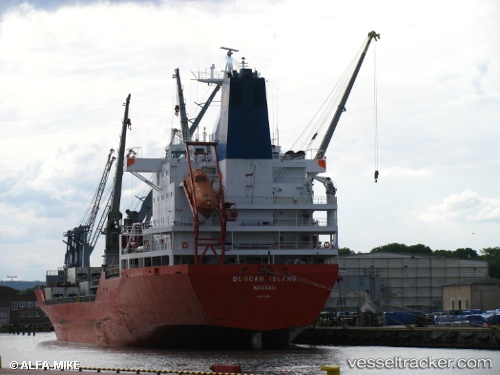
Duncan Island
Current StatusWhere is the vessel?
Duncan Island is currently in 94 nm N of Jarikaba, based on AIS data received about 1h ago.
Latest AIS update:
Current position: 7.27437° N, 55.88628° W (94 nm N of Jarikaba)
Average speed (last 7 days): Loading…
Average speed (last 30 days): Loading…
Vessel profile: Duncan Island is a Refrigerated Cargo Ship with dimensions 25m x 180m.
This page combines live AIS, route history, probable destination signals, nearby traffic, and port activity for practical vessel monitoring.
The current position of vessel Duncan Island is 7.27437 lat / -55.88628 lng. Updated: 2026-05-14 04:15:14 UTCNearest reference points:
- 38 nm NW of Jarikaba
- Near Paramaribo Zorg en Hoop Airport
- 57 nm NE of Adventure
Details:
Live Vessel Duncan Island Analytics (details, animations, etc.)
Recent AIS points (UTC):
2026-05-14 01:12:57 UTC · 7.77835, -56.21359 · SOG 12 kn · COG 137°2026-05-14 01:19:27 UTC · 7.76087, -56.20100 · SOG 11.9 kn · COG 137°
2026-05-14 03:20:47 UTC · 7.42642, -55.98775 · SOG 12.1 kn · COG 139°
2026-05-14 04:15:14 UTC · 7.27437, -55.88628 · SOG 11.7 kn · COG 131°