 vesseltracker.com
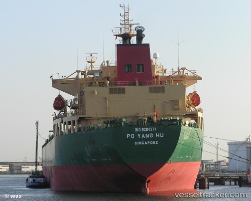
 Po Yang Hu
Current Status
Where is the vessel?
Po Yang Hu is currently in 15 nm W of Lianyungang, based on AIS data received about 9d ago.
Latest AIS update:
Current position: 34.82260° N, 119.16870° E (15 nm W of Lianyungang)
Average speed (last 7 days): Loading…
Average speed (last 30 days): Loading…
Vessel profile: Po Yang Hu is a Crude Oil Tanker with dimensions 228m x 32m.
This page combines live AIS, route history, probable destination signals, nearby traffic, and port activity for practical vessel monitoring.
The current position of vessel Po Yang Hu is 34.82260 lat / 119.16870 lng. Updated: 2026-05-06 07:25:40 UTCNearest reference points:
- Near Lanshan Pt
- Near Lianyungang
- Near LANSHAN
Currently sailing under the flag of China ![]()
Po Yang Hu built in 1994 year
Deadweight:
61957 tDetails:
Live Vessel Po Yang Hu Analytics (details, animations, etc.)
Recent AIS points (UTC):
2026-05-06 07:25:40 UTC · 34.82260, 119.16870 · SOG 0.1 kn · COG 192°2026-05-06 07:25:40 UTC · 34.82260, 119.16870 · SOG 0.1 kn · COG 192°
2026-05-06 07:25:40 UTC · 34.82260, 119.16870 · SOG 0.1 kn · COG 192°
2026-05-06 07:25:40 UTC · 34.82260, 119.16870 · SOG 0.1 kn · COG 192°