 vesseltracker.com
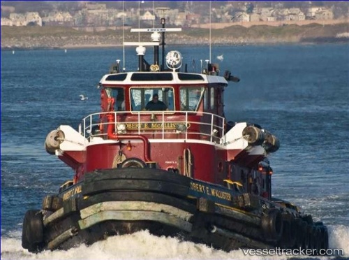
 Robert E. Mcallister
Current Status
Where is the vessel?
Robert E. Mcallister is currently in Near Colwyn, based on AIS data received about 112d ago.
Latest AIS update:
Current position: 39.89644° N, 75.19683° W (Near Colwyn)
Average speed (last 7 days): Loading…
Average speed (last 30 days): Loading…
Vessel profile: Robert E. Mcallister is a Tug with dimensions m x m.
This page combines live AIS, route history, probable destination signals, nearby traffic, and port activity for practical vessel monitoring.
The current position of vessel Robert E. Mcallister is 39.89644 lat / -75.19683 lng. Updated: 2026-01-21 09:15:51 UTCNearest reference points:
- Near Brooklawn
- Near Trainer
- Near Wilmington
Currently sailing under the flag of USA ![]()
Robert E. Mcallister built in 1970 year
Deadweight:
92 tDetails:
Live Vessel Robert E. Mcallister Analytics (details, animations, etc.)
Recent AIS points (UTC):
2026-01-21 09:15:51 UTC · 39.89644, -75.19683 · SOG 0 kn · COG -1°