 vesseltracker.com
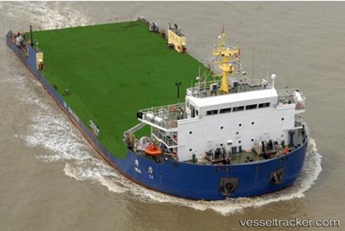
Hua Li
Current StatusWhere is the vessel?
Hua Li is currently in Near Erawan, based on AIS data received less than 1h ago.
Latest AIS update:
Current position: 8.97667° N, 101.46667° E (Near Erawan)
Average speed (last 7 days): Loading…
Average speed (last 30 days): Loading…
Vessel profile: Hua Li is a Heavy Load Carrier with dimensions 29m x 89m.
This page combines live AIS, route history, probable destination signals, nearby traffic, and port activity for practical vessel monitoring.
The current position of vessel Hua Li is 8.97667 lat / 101.46667 lng. Updated: 2026-05-14 07:54:12 UTCNearest reference points:
- 46 nm W of Dai Hung (STS Load)
- 45 nm NW of Muda Marine Terminal
- 63 nm NW of Dai Hung (STS Load)
Details:
Live Vessel Hua Li Analytics (details, animations, etc.)
Recent AIS points (UTC):
2026-05-14 04:42:09 UTC · 8.98833, 101.45667 · SOG 0 kn · COG -1°2026-05-14 05:30:09 UTC · 8.99667, 101.46333 · SOG 1 kn · COG -1°
2026-05-14 07:33:14 UTC · 8.97833, 101.46333 · SOG 0 kn · COG -1°
2026-05-14 07:54:12 UTC · 8.97667, 101.46667 · SOG 0 kn · COG -1°