 vesseltracker.com
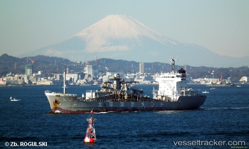
Senyo Maru
Current StatusWhere is the vessel?
Senyo Maru is currently in Near Naka-Ku, Kanagawa, based on AIS data received about 1h ago.
Latest AIS update:
Current position: 35.38487° N, 139.72977° E (Near Naka-Ku, Kanagawa)
Average speed (last 7 days): Loading…
Average speed (last 30 days): Loading…
Vessel profile: Senyo Maru is a Cement Carrier with dimensions 18m x 114m.
This page combines live AIS, route history, probable destination signals, nearby traffic, and port activity for practical vessel monitoring.
The current position of vessel Senyo Maru is 35.38487 lat / 139.72977 lng. Updated: 2026-05-14 19:55:30 UTCNearest reference points:
- Near Yokosuka
- Near Naka-Ku, Kanagawa
- Near Yokohama
Details:
Live Vessel Senyo Maru Analytics (details, animations, etc.)
Recent AIS points (UTC):
2026-05-14 16:55:28 UTC · 35.38498, 139.72957 · SOG 0.1 kn · COG 34°2026-05-14 17:37:28 UTC · 35.38497, 139.72960 · SOG 0.1 kn · COG 35°
2026-05-14 19:28:26 UTC · 35.38498, 139.72957 · SOG 0.1 kn · COG 35°
2026-05-14 19:55:30 UTC · 35.38487, 139.72977 · SOG 0 kn · COG 33°