 vesseltracker.com
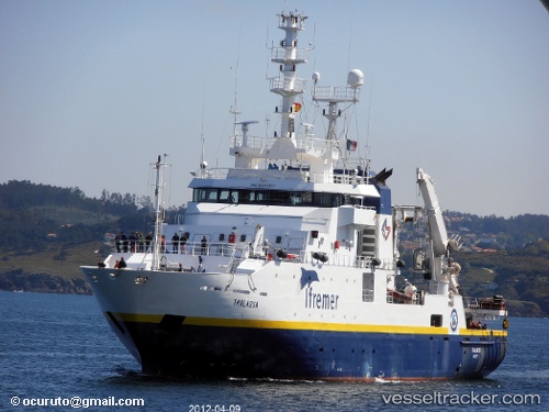
Thalassa
Current StatusWhere is the vessel?
Thalassa is currently in 24 nm NE of Saint-Rémy-sur-Durolle, based on AIS data received about 1h ago.
Latest AIS update:
Current position: 46.24508° N, 3.36784° W (24 nm NE of Saint-Rémy-sur-Durolle)
Average speed (last 7 days): Loading…
Average speed (last 30 days): Loading…
Vessel profile: Thalassa is a Fishing Support Vessel with dimensions 14m x 74m.
This page combines live AIS, route history, probable destination signals, nearby traffic, and port activity for practical vessel monitoring.
The current position of vessel Thalassa is 46.24508 lat / -3.36784 lng. Updated: 2026-05-16 13:28:00 UTCNearest reference points:
- 17 nm S of L'Île-d'Yeu
- 13 nm S of Saint-Céols
- 12 nm S of Saint-Céols
Thalassa built in 1996 year
Details:
Live Vessel Thalassa Analytics (details, animations, etc.)
Recent AIS points (UTC):
2026-05-16 10:08:02 UTC · 46.07568, -3.20130 · SOG 10.5 kn · COG 63°2026-05-16 12:12:01 UTC · 46.28463, -3.10972 · SOG 9.6 kn · COG 303°
2026-05-16 13:14:00 UTC · 46.26498, -3.31749 · SOG 10.1 kn · COG 244°
2026-05-16 13:28:00 UTC · 46.24508, -3.36784 · SOG 10.2 kn · COG 244°