 vesseltracker.com
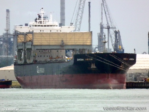
 Grebe Arrow
Current Status
Where is the vessel?
Grebe Arrow is currently in 18 nm SE of Nishitokyo, based on AIS data received less than 1h ago.
Latest AIS update:
Current position: 34.55697° N, 139.81883° E (18 nm SE of Nishitokyo)
Average speed (last 7 days): Loading…
Average speed (last 30 days): Loading…
Vessel profile: Grebe Arrow is a Multi Purpose Carrier with dimensions 200m x 32m.
This page combines live AIS, route history, probable destination signals, nearby traffic, and port activity for practical vessel monitoring.
The current position of vessel Grebe Arrow is 34.55697 lat / 139.81883 lng. Updated: 2026-05-15 14:21:22 UTCNearest reference points:
- Near Nishitokyo
- Near Toshima/Tokyo
- 15 nm S of Zushi
Currently sailing under the flag of Bahamas ![]()
Grebe Arrow built in 1997 year
Deadweight:
55671 tDetails:
Live Vessel Grebe Arrow Analytics (details, animations, etc.)
Recent AIS points (UTC):
2026-05-15 10:03:53 UTC · 33.88667, 140.17500 · SOG 10 kn · COG -1°2026-05-15 11:52:05 UTC · 34.17833, 140.02333 · SOG 11 kn · COG -1°
2026-05-15 13:29:41 UTC · 34.44548, 139.87843 · SOG 8.8 kn · COG 327°
2026-05-15 14:21:22 UTC · 34.55697, 139.81883 · SOG 8.2 kn · COG 336°