 vesseltracker.com
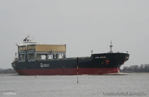
Kite Arrow
Current StatusWhere is the vessel?
Kite Arrow is currently in 11 nm W of Largs Bay, based on AIS data received less than 1h ago.
Latest AIS update:
Current position: 34.82935° S, 138.25037° E (11 nm W of Largs Bay)
Average speed (last 7 days): Loading…
Average speed (last 30 days): Loading…
Vessel profile: Kite Arrow is a Multi Purpose Carrier with dimensions 32m x 200m.
This page combines live AIS, route history, probable destination signals, nearby traffic, and port activity for practical vessel monitoring.
The current position of vessel Kite Arrow is -34.82935 lat / 138.25037 lng. Updated: 2026-04-29 02:24:49 UTCNearest reference points:
- Near North Haven
- Near Port Adelaide
- Near Gillman
Details:
Live Vessel Kite Arrow Analytics (details, animations, etc.)
Recent AIS points (UTC):
2026-04-28 22:57:50 UTC · -34.83255, 138.25027 · SOG 0 kn · COG 20°2026-04-29 00:21:51 UTC · -34.83213, 138.24954 · SOG 0 kn · COG 46°
2026-04-29 01:09:51 UTC · -34.83175, 138.24927 · SOG 0.1 kn · COG 61°
2026-04-29 02:24:49 UTC · -34.82935, 138.25037 · SOG 0 kn · COG 151°