 vesseltracker.com
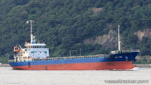
 SWIFT
SWIFT
Current Status
Where is the vessel?
SWIFT is currently in Near Fushikitoyama, based on AIS data received about 1h ago.
Latest AIS update:
Current position: 36.96333° N, 137.15500° E (Near Fushikitoyama)
Average speed (last 7 days): Loading…
Average speed (last 30 days): Loading…
Vessel profile: SWIFT is a Cargo with dimensions m x m.
This page combines live AIS, route history, probable destination signals, nearby traffic, and port activity for practical vessel monitoring.
The current position of vessel SWIFT is 36.96333 lat / 137.15500 lng. Updated: 2026-05-14 19:55:14 UTCNearest reference points:
- Near Toyama
- 63 nm NW of Sado Shima Apt
- Near Nagoya
Currently sailing under the flag of Palau ![]()
Details:
Live Vessel SWIFT Analytics (details, animations, etc.)
Recent AIS points (UTC):
2026-05-14 16:49:16 UTC · 36.97833, 137.16833 · SOG 0 kn · COG -1°2026-05-14 17:37:16 UTC · 36.97500, 137.16667 · SOG 0 kn · COG -1°
2026-05-14 19:26:13 UTC · 36.96666, 137.16029 · SOG 0.4 kn · COG 310°
2026-05-14 19:55:14 UTC · 36.96333, 137.15500 · SOG 0 kn · COG -1°